Maps
Maps
Maps for
Emergency Response
From medical response emergency preparedness to
fire department dispatch zoning MarketMAPS custom maps are a great tool for emergency response.
Features Commonly Used on
Emergency Response Maps
Emergency Response Maps
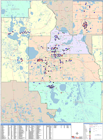
Points of Interest
Drive Time Polygons
Laminated
Police & Fire Departments
Hospitals
Government Centers
Schools
Street Level DetailHospitals
Government Centers
Schools
Evacuation Routes
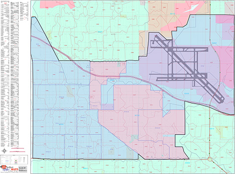
Highways
All Streets
Waterways
Border Crossings
Up-to-Date and Accurate Levels of GeographyHighways
All Streets
Waterways
Border Crossings
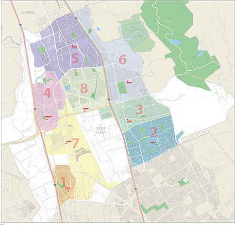
Residential & Commercial Zoning Boundaries
Government Jurisdiction Boundaries
School District Boundaries
ZIP Code Boundaries
County Boundaries
State Boundaries
Custom Boundaries, Dispatch Zones etc.
Radius RingsGovernment Jurisdiction Boundaries
School District Boundaries
ZIP Code Boundaries
County Boundaries
State Boundaries
Custom Boundaries, Dispatch Zones etc.
Drive Time Polygons
Laminated
Draw, write and erase directly on maps.
Custom Colors and Themes
Formats

Digital Maps
Any Size or Format
AI or PDF
Wall MapsAI or PDF
2x3 to 9x12 feet and larger
Laminated, Framed, Magnetic and more
Custom sizing available
Printed MapsLaminated, Framed, Magnetic and more
Custom sizing available
8.5x11 to 17x22 inches
Custom sizing available
Map BooksCustom sizing available
8.5x11 and 11x17 inches


Consult with an Expert on Your Project
Get a FREE Quote…FAST
Contact an Expert
Our experts will quickly answer your questions and
help you find the best solution for your business. A Real Expert will Contact You...Fast!
help you find the best solution for your business. A Real Expert will Contact You...Fast!
Talk to an Expert
Need help fast? Our phones are staffed from
Monday through Friday, 8am to 5pm EST. Call 1-888-434-6277
Monday through Friday, 8am to 5pm EST. Call 1-888-434-6277